Mean State
Download Data |
Period Mean (original grids) [Pg] |
Model Period Mean (intersection) [Pg] |
Model Period Mean (complement) [Pg] |
Benchmark Period Mean (intersection) [Pg] |
Benchmark Period Mean (complement) [Pg] |
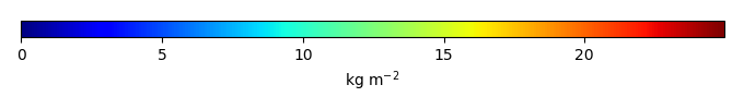
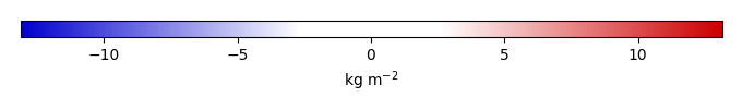
Bias [kg m-2] |
Bias Score [1] |
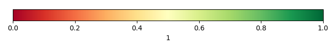
Spatial Distribution Score [1] |
Overall Score [1] |
|||
|---|---|---|---|---|---|---|---|---|---|---|---|---|
| Benchmark | [-] | 26.2 | ||||||||||
| CRUNCEPv7 | [-] | 589. | 21.7 | 567. | 26.1 | 0.0878 | -0.243 | 0.616 | 0.874 | 0.745 | ||
| GSWP3v1 | [-] | 487. | 15.3 | 472. | 26.1 | 0.0878 | -1.07 | 0.599 | 0.789 | 0.694 | ||
| WATCH | [-] | 505. | 17.4 | 488. | 26.1 | 0.0878 | -0.829 | 0.630 | 0.805 | 0.717 |
Download Data |
Period Mean (original grids) [Pg] |
Model Period Mean (intersection) [Pg] |
Model Period Mean (complement) [Pg] |
Benchmark Period Mean (intersection) [Pg] |
Benchmark Period Mean (complement) [Pg] |
Bias [kg m-2] |
Bias Score [1] |
Spatial Distribution Score [1] |
Overall Score [1] |
|||
|---|---|---|---|---|---|---|---|---|---|---|---|---|
| Benchmark | [-] | 0.00338 | ||||||||||
| CRUNCEPv7 | [-] | 11.9 | 0.0255 | 11.6 | 0.00338 | 0.302 | 0.360 | 0.401 | 0.380 | |||
| GSWP3v1 | [-] | 10.2 | 0.0260 | 9.91 | 0.00338 | 0.333 | 0.269 | 0.365 | 0.317 | |||
| WATCH | [-] | 10.8 | 0.0329 | 10.6 | 0.00338 | 0.444 | 0.0850 | 0.183 | 0.134 |
Download Data |
Period Mean (original grids) [Pg] |
Model Period Mean (intersection) [Pg] |
Model Period Mean (complement) [Pg] |
Benchmark Period Mean (intersection) [Pg] |
Benchmark Period Mean (complement) [Pg] |
Bias [kg m-2] |
Bias Score [1] |
Spatial Distribution Score [1] |
Overall Score [1] |
|||
|---|---|---|---|---|---|---|---|---|---|---|---|---|
| Benchmark | [-] | 17.5 | ||||||||||
| CRUNCEPv7 | [-] | 17.8 | 17.4 | 0.303 | 17.4 | 0.0333 | 0.386 | 0.671 | 0.907 | 0.789 | ||
| GSWP3v1 | [-] | 12.0 | 11.6 | 0.234 | 17.4 | 0.0333 | -1.09 | 0.649 | 0.883 | 0.766 | ||
| WATCH | [-] | 13.9 | 13.6 | 0.224 | 17.4 | 0.0333 | -0.644 | 0.693 | 0.890 | 0.792 |
Download Data |
Period Mean (original grids) [Pg] |
Model Period Mean (intersection) [Pg] |
Model Period Mean (complement) [Pg] |
Benchmark Period Mean (intersection) [Pg] |
Benchmark Period Mean (complement) [Pg] |
Bias [kg m-2] |
Bias Score [1] |
Spatial Distribution Score [1] |
Overall Score [1] |
|||
|---|---|---|---|---|---|---|---|---|---|---|---|---|
| Benchmark | [-] | 0.222 | ||||||||||
| CRUNCEPv7 | [-] | 56.8 | 0.907 | 56.1 | 0.222 | 8.04 | 0.289 | 0.391 | 0.340 | |||
| GSWP3v1 | [-] | 43.6 | 0.598 | 43.2 | 0.222 | 4.61 | 0.414 | 0.642 | 0.528 | |||
| WATCH | [-] | 38.9 | 0.525 | 38.5 | 0.222 | 3.88 | 0.490 | 0.684 | 0.587 |
Download Data |
Period Mean (original grids) [Pg] |
Model Period Mean (intersection) [Pg] |
Model Period Mean (complement) [Pg] |
Benchmark Period Mean (intersection) [Pg] |
Benchmark Period Mean (complement) [Pg] |
Bias [kg m-2] |
Bias Score [1] |
Spatial Distribution Score [1] |
Overall Score [1] |
|||
|---|---|---|---|---|---|---|---|---|---|---|---|---|
| Benchmark | [-] | 8.47 | ||||||||||
| CRUNCEPv7 | [-] | 3.49 | 3.46 | 0.0505 | 8.42 | 0.0520 | -1.12 | 0.507 | 0.698 | 0.603 | ||
| GSWP3v1 | [-] | 3.04 | 3.04 | 0.0355 | 8.42 | 0.0520 | -1.23 | 0.500 | 0.546 | 0.523 | ||
| WATCH | [-] | 3.35 | 3.33 | 0.0476 | 8.42 | 0.0520 | -1.17 | 0.501 | 0.566 | 0.533 |
Temporally integrated period mean