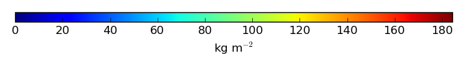
Mean State
Download Data |
Period Mean (original grids) [Pg] |
Model Period Mean (intersection) [Pg] |
Model Period Mean (complement) [Pg] |
Benchmark Period Mean (intersection) [Pg] |
Benchmark Period Mean (complement) [Pg] |
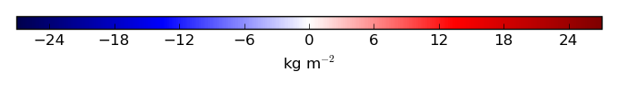
Bias [kg m-2] |
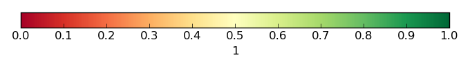
Bias Score [1] |
Spatial Distribution Score [1] |
Overall Score [1] |
|||
|---|---|---|---|---|---|---|---|---|---|---|---|---|
| Benchmark | [-] | 1.38e+03 | ||||||||||
| CLM5BGC_CRUNCEP | [-] | 1.92e+03 | 1.89e+03 | 22.6 | 1.32e+03 | 56.4 | 4.99 | 0.091 | 0.10 | 0.096 | ||
| CLM5BGC_GSWP3 | [-] | 1.05e+03 | 1.04e+03 | 16.5 | 1.32e+03 | 56.4 | -1.33 | 0.090 | 0.43 | 0.26 | ||
| CLM5BGC_WATCH | [-] | 1.09e+03 | 1.07e+03 | 17.3 | 1.32e+03 | 56.4 | -1.11 | 0.093 | 0.33 | 0.21 |
Temporally integrated period mean