Mean State
Download Data |
Period Mean (original grids) [Pg] |
Model Period Mean (intersection) [Pg] |
Benchmark Period Mean (intersection) [Pg] |
Model Period Mean (complement) [Pg] |
Benchmark Period Mean (complement) [Pg] |
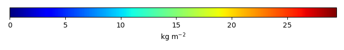
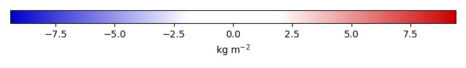
Bias [kg m-2] |
Bias Score [1] |
Spatial Distribution Score [1] |
Overall Score [1] |
|||
|---|---|---|---|---|---|---|---|---|---|---|---|---|
| Benchmark | [-] | 26.2 | ||||||||||
| CLM50 | [-] | 563. | 22.6 | 26.1 | 538. | 0.0852 | -0.125 | 0.444 | 0.884 | 0.664 | ||
| CTSM51 | [-] | 611. | 27.1 | 26.1 | 582. | 0.0852 | 0.453 | 0.422 | 0.894 | 0.658 | ||
| DeadVeg | [-] | 834. | 30.1 | 26.1 | 802. | 0.0852 | 0.781 | 0.401 | 0.867 | 0.634 |
Download Data |
Period Mean (original grids) [Pg] |
Model Period Mean (intersection) [Pg] |
Benchmark Period Mean (intersection) [Pg] |
Model Period Mean (complement) [Pg] |
Benchmark Period Mean (complement) [Pg] |
Bias [kg m-2] |
Bias Score [1] |
Spatial Distribution Score [1] |
Overall Score [1] |
|||
|---|---|---|---|---|---|---|---|---|---|---|---|---|
| Benchmark | [-] | 0.00338 | ||||||||||
| CLM50 | [-] | 12.1 | 0.0348 | 0.00338 | 11.7 | 0.457 | 0.0513 | 0.254 | 0.152 | |||
| CTSM51 | [-] | 13.1 | 0.0477 | 0.00338 | 12.7 | 0.660 | 0.0448 | 0.120 | 0.0823 | |||
| DeadVeg | [-] | 15.5 | 0.0630 | 0.00338 | 15.1 | 0.854 | 0.00895 | 0.121 | 0.0652 |
Download Data |
Period Mean (original grids) [Pg] |
Model Period Mean (intersection) [Pg] |
Benchmark Period Mean (intersection) [Pg] |
Model Period Mean (complement) [Pg] |
Benchmark Period Mean (complement) [Pg] |
Bias [kg m-2] |
Bias Score [1] |
Spatial Distribution Score [1] |
Overall Score [1] |
|||
|---|---|---|---|---|---|---|---|---|---|---|---|---|
| Benchmark | [-] | 17.5 | ||||||||||
| CLM50 | [-] | 17.6 | 17.2 | 17.4 | 0.303 | 0.0333 | 0.364 | 0.587 | 0.926 | 0.756 | ||
| CTSM51 | [-] | 18.7 | 18.3 | 17.4 | 0.328 | 0.0333 | 0.647 | 0.550 | 0.903 | 0.727 | ||
| DeadVeg | [-] | 20.5 | 20.1 | 17.4 | 0.307 | 0.0333 | 1.02 | 0.517 | 0.841 | 0.679 |
Download Data |
Period Mean (original grids) [Pg] |
Model Period Mean (intersection) [Pg] |
Benchmark Period Mean (intersection) [Pg] |
Model Period Mean (complement) [Pg] |
Benchmark Period Mean (complement) [Pg] |
Bias [kg m-2] |
Bias Score [1] |
Spatial Distribution Score [1] |
Overall Score [1] |
|||
|---|---|---|---|---|---|---|---|---|---|---|---|---|
| Benchmark | [-] | 0.222 | ||||||||||
| CLM50 | [-] | 48.5 | 0.764 | 0.222 | 48.0 | 6.48 | 0.194 | 0.500 | 0.347 | |||
| CTSM51 | [-] | 52.7 | 0.862 | 0.222 | 52.1 | 7.53 | 0.181 | 0.419 | 0.300 | |||
| DeadVeg | [-] | 60.5 | 0.891 | 0.222 | 59.9 | 7.71 | 0.151 | 0.404 | 0.278 |
Download Data |
Period Mean (original grids) [Pg] |
Model Period Mean (intersection) [Pg] |
Benchmark Period Mean (intersection) [Pg] |
Model Period Mean (complement) [Pg] |
Benchmark Period Mean (complement) [Pg] |
Bias [kg m-2] |
Bias Score [1] |
Spatial Distribution Score [1] |
Overall Score [1] |
|||
|---|---|---|---|---|---|---|---|---|---|---|---|---|
| Benchmark | [-] | 8.47 | ||||||||||
| CLM50 | [-] | 4.58 | 4.57 | 8.42 | 0.0547 | 0.0520 | -0.816 | 0.308 | 0.704 | 0.506 | ||
| CTSM51 | [-] | 7.90 | 7.88 | 8.42 | 0.0738 | 0.0520 | 0.0669 | 0.299 | 0.880 | 0.590 | ||
| DeadVeg | [-] | 9.12 | 9.09 | 8.42 | 0.0897 | 0.0520 | 0.360 | 0.293 | 0.899 | 0.596 |
Temporally integrated period mean