Mean State
Download Data |
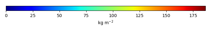
Period Mean (original grids) [Pg] |
Model Period Mean (intersection) [Pg] |
Model Period Mean (complement) [Pg] |
Benchmark Period Mean (intersection) [Pg] |
Benchmark Period Mean (complement) [Pg] |
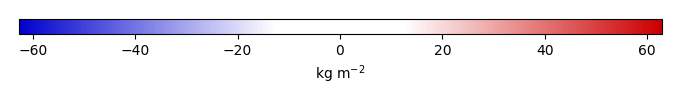
Bias [kg m-2] |
Bias Score [1] |
Spatial Distribution Score [1] |
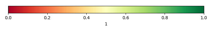
Overall Score [1] |
|||
|---|---|---|---|---|---|---|---|---|---|---|---|---|
| Benchmark | [-] | 76.5 | ||||||||||
| CESM2_1_001 | [-] | 62.8 | 59.0 | 3.98 | 76.1 | 0.362 | -5.36 | 0.579 | 0.564 | 0.571 | ||
| CESM2_1_002 | [-] | 62.7 | 58.9 | 3.96 | 76.1 | 0.362 | -5.38 | 0.578 | 0.563 | 0.570 | ||
| CESM2_1_003 | [-] | 62.9 | 59.1 | 3.98 | 76.1 | 0.362 | -5.31 | 0.579 | 0.563 | 0.571 | ||
| CRUJRA | [-] | 196. | 180. | 15.5 | 76.1 | 0.362 | 39.1 | 0.355 | 0.122 | 0.239 | ||
| GSWP3 | [-] | 99.3 | 89.3 | 9.84 | 76.1 | 0.362 | 5.79 | 0.533 | 0.297 | 0.415 | ||
| LENS1 | [-] | 4.25 | 3.81 | 0.543 | 76.1 | 0.362 | -25.5 | 0.390 | 0.0780 | 0.234 | ||
| LENS10 | [-] | 4.24 | 3.80 | 0.539 | 76.1 | 0.362 | -25.5 | 0.390 | 0.0779 | 0.234 | ||
| LENS5 | [-] | 4.24 | 3.80 | 0.541 | 76.1 | 0.362 | -25.5 | 0.390 | 0.0778 | 0.234 | ||
| PRINCETON | [-] | 297. | 283. | 15.5 | 76.1 | 0.362 | 75.7 | 0.289 | 0.0598 | 0.174 |
Download Data |
Period Mean (original grids) [Pg] |
Model Period Mean (intersection) [Pg] |
Model Period Mean (complement) [Pg] |
Benchmark Period Mean (intersection) [Pg] |
Benchmark Period Mean (complement) [Pg] |
Bias [kg m-2] |
Bias Score [1] |
Spatial Distribution Score [1] |
Overall Score [1] |
|||
|---|---|---|---|---|---|---|---|---|---|---|---|---|
| Benchmark | [-] | 113. | ||||||||||
| CESM2_1_001 | [-] | 149. | 90.7 | 54.8 | 113. | 0.00185 | -4.71 | 0.649 | 0.706 | 0.678 | ||
| CESM2_1_002 | [-] | 149. | 90.7 | 55.0 | 113. | 0.00185 | -4.70 | 0.649 | 0.707 | 0.678 | ||
| CESM2_1_003 | [-] | 149. | 90.7 | 55.1 | 113. | 0.00185 | -4.70 | 0.649 | 0.704 | 0.677 | ||
| CRUJRA | [-] | 244. | 157. | 82.1 | 113. | 0.00185 | 8.93 | 0.602 | 0.824 | 0.713 | ||
| GSWP3 | [-] | 134. | 70.8 | 60.0 | 113. | 0.00185 | -8.94 | 0.563 | 0.826 | 0.694 | ||
| LENS1 | [-] | 57.2 | 34.4 | 21.3 | 113. | 0.00185 | -16.4 | 0.505 | 0.163 | 0.334 | ||
| LENS10 | [-] | 57.1 | 34.4 | 21.3 | 113. | 0.00185 | -16.4 | 0.505 | 0.163 | 0.334 | ||
| LENS5 | [-] | 57.0 | 34.3 | 21.2 | 113. | 0.00185 | -16.4 | 0.505 | 0.162 | 0.333 | ||
| PRINCETON | [-] | 297. | 207. | 83.6 | 113. | 0.00185 | 19.5 | 0.534 | 0.436 | 0.485 |
Download Data |
Period Mean (original grids) [Pg] |
Model Period Mean (intersection) [Pg] |
Model Period Mean (complement) [Pg] |
Benchmark Period Mean (intersection) [Pg] |
Benchmark Period Mean (complement) [Pg] |
Bias [kg m-2] |
Bias Score [1] |
Spatial Distribution Score [1] |
Overall Score [1] |
|||
|---|---|---|---|---|---|---|---|---|---|---|---|---|
| Benchmark | [-] | 12.2 | ||||||||||
| CESM2_1_001 | [-] | 117. | 12.3 | 108. | 12.2 | 0.149 | 0.645 | 0.771 | 0.708 | |||
| CESM2_1_002 | [-] | 117. | 12.4 | 108. | 12.2 | 0.243 | 0.647 | 0.772 | 0.709 | |||
| CESM2_1_003 | [-] | 117. | 12.3 | 107. | 12.2 | 0.213 | 0.645 | 0.770 | 0.708 | |||
| CRUJRA | [-] | 114. | 12.7 | 105. | 12.2 | 1.06 | 0.599 | 0.348 | 0.473 | |||
| GSWP3 | [-] | 92.5 | 5.25 | 89.6 | 12.2 | -7.03 | 0.544 | 0.819 | 0.682 | |||
| LENS1 | [-] | 82.3 | 6.06 | 77.3 | 12.2 | -6.45 | 0.598 | 0.828 | 0.713 | |||
| LENS10 | [-] | 82.4 | 6.07 | 77.5 | 12.2 | -6.44 | 0.599 | 0.828 | 0.713 | |||
| LENS5 | [-] | 82.3 | 6.07 | 77.3 | 12.2 | -6.45 | 0.599 | 0.828 | 0.713 | |||
| PRINCETON | [-] | 189. | 33.9 | 160. | 12.2 | 21.0 | 0.455 | 0.0537 | 0.254 |
Download Data |
Period Mean (original grids) [Pg] |
Model Period Mean (intersection) [Pg] |
Model Period Mean (complement) [Pg] |
Benchmark Period Mean (intersection) [Pg] |
Benchmark Period Mean (complement) [Pg] |
Bias [kg m-2] |
Bias Score [1] |
Spatial Distribution Score [1] |
Overall Score [1] |
|||
|---|---|---|---|---|---|---|---|---|---|---|---|---|
| Benchmark | [-] | 97.3 | ||||||||||
| CESM2_1_001 | [-] | 44.4 | 43.8 | 1.26 | 97.2 | 0.0996 | -16.8 | 0.468 | 0.585 | 0.526 | ||
| CESM2_1_002 | [-] | 44.5 | 43.8 | 1.25 | 97.2 | 0.0996 | -16.8 | 0.468 | 0.585 | 0.527 | ||
| CESM2_1_003 | [-] | 44.4 | 43.7 | 1.26 | 97.2 | 0.0996 | -16.8 | 0.468 | 0.586 | 0.527 | ||
| CRUJRA | [-] | 200. | 187. | 15.6 | 97.2 | 0.0996 | 29.2 | 0.486 | 0.223 | 0.355 | ||
| GSWP3 | [-] | 119. | 111. | 10.1 | 97.2 | 0.0996 | 4.67 | 0.549 | 0.396 | 0.472 | ||
| LENS1 | [-] | 3.03 | 2.94 | 0.352 | 97.2 | 0.0996 | -29.9 | 0.380 | 0.0410 | 0.211 | ||
| LENS10 | [-] | 3.02 | 2.94 | 0.350 | 97.2 | 0.0996 | -29.9 | 0.380 | 0.0408 | 0.210 | ||
| LENS5 | [-] | 3.03 | 2.94 | 0.351 | 97.2 | 0.0996 | -29.9 | 0.380 | 0.0409 | 0.211 | ||
| PRINCETON | [-] | 209. | 193. | 17.5 | 97.2 | 0.0996 | 30.8 | 0.513 | 0.248 | 0.381 |
Download Data |
Period Mean (original grids) [Pg] |
Model Period Mean (intersection) [Pg] |
Model Period Mean (complement) [Pg] |
Benchmark Period Mean (intersection) [Pg] |
Benchmark Period Mean (complement) [Pg] |
Bias [kg m-2] |
Bias Score [1] |
Spatial Distribution Score [1] |
Overall Score [1] |
|||
|---|---|---|---|---|---|---|---|---|---|---|---|---|
| Benchmark | [-] | 5.12 | ||||||||||
| CESM2_1_001 | [-] | 36.5 | 1.64 | 34.4 | 5.12 | -13.0 | 0.492 | 0.316 | 0.404 | |||
| CESM2_1_002 | [-] | 36.6 | 1.64 | 34.5 | 5.12 | -12.9 | 0.492 | 0.314 | 0.403 | |||
| CESM2_1_003 | [-] | 36.4 | 1.64 | 34.3 | 5.12 | -12.9 | 0.493 | 0.313 | 0.403 | |||
| CRUJRA | [-] | 59.9 | 4.22 | 54.8 | 5.12 | -3.42 | 0.669 | 0.669 | 0.669 | |||
| GSWP3 | [-] | 44.4 | 3.44 | 40.2 | 5.12 | -6.39 | 0.638 | 0.667 | 0.652 | |||
| LENS1 | [-] | 18.2 | 0.272 | 17.7 | 5.12 | -17.9 | 0.388 | 0.0127 | 0.200 | |||
| LENS10 | [-] | 18.3 | 0.275 | 17.8 | 5.12 | -17.9 | 0.388 | 0.0130 | 0.201 | |||
| LENS5 | [-] | 18.2 | 0.272 | 17.7 | 5.12 | -17.9 | 0.388 | 0.0128 | 0.200 | |||
| PRINCETON | [-] | 57.7 | 4.03 | 52.8 | 5.12 | -4.16 | 0.666 | 0.542 | 0.604 |
Download Data |
Period Mean (original grids) [Pg] |
Model Period Mean (intersection) [Pg] |
Model Period Mean (complement) [Pg] |
Benchmark Period Mean (intersection) [Pg] |
Benchmark Period Mean (complement) [Pg] |
Bias [kg m-2] |
Bias Score [1] |
Spatial Distribution Score [1] |
Overall Score [1] |
|||
|---|---|---|---|---|---|---|---|---|---|---|---|---|
| Benchmark | [-] | 475. | ||||||||||
| CESM2_1_001 | [-] | 967. | 321. | 646. | 474. | 1.51 | -5.31 | 0.545 | 0.248 | 0.397 | ||
| CESM2_1_002 | [-] | 967. | 321. | 646. | 474. | 1.51 | -5.30 | 0.545 | 0.248 | 0.397 | ||
| CESM2_1_003 | [-] | 967. | 321. | 646. | 474. | 1.51 | -5.29 | 0.546 | 0.248 | 0.397 | ||
| CRUJRA | [-] | 1.57e+03 | 785. | 786. | 474. | 1.51 | 14.6 | 0.509 | 0.355 | 0.432 | ||
| GSWP3 | [-] | 1.05e+03 | 432. | 622. | 474. | 1.51 | -1.47 | 0.536 | 0.644 | 0.590 | ||
| LENS1 | [-] | 548. | 70.0 | 478. | 474. | 1.51 | -17.8 | 0.433 | 0.118 | 0.275 | ||
| LENS10 | [-] | 549. | 70.0 | 479. | 474. | 1.51 | -17.8 | 0.433 | 0.118 | 0.275 | ||
| LENS5 | [-] | 548. | 69.9 | 478. | 474. | 1.51 | -17.8 | 0.433 | 0.118 | 0.275 | ||
| PRINCETON | [-] | 2.00e+03 | 1.12e+03 | 880. | 474. | 1.51 | 29.3 | 0.479 | 0.162 | 0.321 |
Download Data |
Period Mean (original grids) [Pg] |
Model Period Mean (intersection) [Pg] |
Model Period Mean (complement) [Pg] |
Benchmark Period Mean (intersection) [Pg] |
Benchmark Period Mean (complement) [Pg] |
Bias [kg m-2] |
Bias Score [1] |
Spatial Distribution Score [1] |
Overall Score [1] |
|||
|---|---|---|---|---|---|---|---|---|---|---|---|---|
| Benchmark | [-] | 116. | ||||||||||
| CESM2_1_001 | [-] | 100. | 75.9 | 25.4 | 116. | 0.373 | -2.93 | 0.481 | 0.127 | 0.304 | ||
| CESM2_1_002 | [-] | 100. | 76.0 | 25.4 | 116. | 0.373 | -2.93 | 0.481 | 0.127 | 0.304 | ||
| CESM2_1_003 | [-] | 101. | 76.0 | 25.4 | 116. | 0.373 | -2.93 | 0.481 | 0.127 | 0.304 | ||
| CRUJRA | [-] | 201. | 189. | 12.4 | 116. | 0.373 | 13.9 | 0.491 | 0.352 | 0.421 | ||
| GSWP3 | [-] | 123. | 115. | 7.52 | 116. | 0.373 | 0.679 | 0.493 | 0.628 | 0.561 | ||
| LENS1 | [-] | 13.5 | 12.6 | 0.759 | 116. | 0.373 | -17.0 | 0.414 | 0.0529 | 0.234 | ||
| LENS10 | [-] | 13.5 | 12.6 | 0.759 | 116. | 0.373 | -17.0 | 0.414 | 0.0528 | 0.233 | ||
| LENS5 | [-] | 13.5 | 12.6 | 0.757 | 116. | 0.373 | -17.0 | 0.414 | 0.0528 | 0.234 | ||
| PRINCETON | [-] | 350. | 336. | 14.9 | 116. | 0.373 | 38.4 | 0.469 | 0.0961 | 0.283 |
Download Data |
Period Mean (original grids) [Pg] |
Model Period Mean (intersection) [Pg] |
Model Period Mean (complement) [Pg] |
Benchmark Period Mean (intersection) [Pg] |
Benchmark Period Mean (complement) [Pg] |
Bias [kg m-2] |
Bias Score [1] |
Spatial Distribution Score [1] |
Overall Score [1] |
|||
|---|---|---|---|---|---|---|---|---|---|---|---|---|
| Benchmark | [-] | 0.0131 | ||||||||||
| CESM2_1_001 | [-] | 22.0 | 0.0151 | 21.6 | 0.0131 | 0.916 | 0.856 | 2.56e-22 | 0.428 | |||
| CESM2_1_002 | [-] | 22.1 | 0.0151 | 21.7 | 0.0131 | 0.915 | 0.857 | 2.86e-22 | 0.428 | |||
| CESM2_1_003 | [-] | 22.1 | 0.0151 | 21.6 | 0.0131 | 0.944 | 0.852 | 3.03e-22 | 0.426 | |||
| CRUJRA | [-] | 38.3 | 0.0212 | 37.6 | 0.0131 | 3.66 | 0.537 | 1.53e-20 | 0.269 | |||
| GSWP3 | [-] | 31.7 | 0.0173 | 31.0 | 0.0131 | 1.97 | 0.718 | 2.53e-23 | 0.359 | |||
| LENS1 | [-] | 27.7 | 0.0182 | 27.2 | 0.0131 | 2.28 | 0.680 | 7.02e-23 | 0.340 | |||
| LENS10 | [-] | 27.8 | 0.0180 | 27.3 | 0.0131 | 2.19 | 0.690 | 1.11e-22 | 0.345 | |||
| LENS5 | [-] | 27.8 | 0.0181 | 27.3 | 0.0131 | 2.26 | 0.682 | 7.48e-23 | 0.341 | |||
| PRINCETON | [-] | 39.5 | 0.0238 | 38.8 | 0.0131 | 4.87 | 0.438 | 1.37e-22 | 0.219 |
Download Data |
Period Mean (original grids) [Pg] |
Model Period Mean (intersection) [Pg] |
Model Period Mean (complement) [Pg] |
Benchmark Period Mean (intersection) [Pg] |
Benchmark Period Mean (complement) [Pg] |
Bias [kg m-2] |
Bias Score [1] |
Spatial Distribution Score [1] |
Overall Score [1] |
|||
|---|---|---|---|---|---|---|---|---|---|---|---|---|
| Benchmark | [-] | 46.1 | ||||||||||
| CESM2_1_001 | [-] | 58.5 | 29.8 | 28.5 | 46.1 | 0.00725 | -7.97 | 0.565 | 0.532 | 0.548 | ||
| CESM2_1_002 | [-] | 58.6 | 29.8 | 28.5 | 46.1 | 0.00725 | -7.97 | 0.565 | 0.533 | 0.549 | ||
| CESM2_1_003 | [-] | 58.7 | 29.8 | 28.5 | 46.1 | 0.00725 | -7.96 | 0.565 | 0.533 | 0.549 | ||
| CRUJRA | [-] | 103. | 53.6 | 49.3 | 46.1 | 0.00725 | 3.27 | 0.599 | 0.867 | 0.733 | ||
| GSWP3 | [-] | 74.8 | 35.8 | 39.3 | 46.1 | 0.00725 | -5.00 | 0.563 | 0.575 | 0.569 | ||
| LENS1 | [-] | 25.3 | 9.65 | 15.9 | 46.1 | 0.00725 | -17.5 | 0.455 | 0.0761 | 0.265 | ||
| LENS10 | [-] | 25.3 | 9.64 | 15.9 | 46.1 | 0.00725 | -17.5 | 0.454 | 0.0757 | 0.265 | ||
| LENS5 | [-] | 25.4 | 9.65 | 16.0 | 46.1 | 0.00725 | -17.5 | 0.455 | 0.0760 | 0.265 | ||
| PRINCETON | [-] | 114. | 56.1 | 57.9 | 46.1 | 0.00725 | 4.43 | 0.596 | 0.870 | 0.733 |
Download Data |
Period Mean (original grids) [Pg] |
Model Period Mean (intersection) [Pg] |
Model Period Mean (complement) [Pg] |
Benchmark Period Mean (intersection) [Pg] |
Benchmark Period Mean (complement) [Pg] |
Bias [kg m-2] |
Bias Score [1] |
Spatial Distribution Score [1] |
Overall Score [1] |
|||
|---|---|---|---|---|---|---|---|---|---|---|---|---|
| Benchmark | [-] | 0.232 | ||||||||||
| CESM2_1_001 | [-] | 7.77 | 0.127 | 8.11 | 0.232 | -2.51 | 0.537 | 0.242 | 0.390 | |||
| CESM2_1_002 | [-] | 7.79 | 0.130 | 8.12 | 0.232 | -2.46 | 0.537 | 0.254 | 0.395 | |||
| CESM2_1_003 | [-] | 7.82 | 0.131 | 8.16 | 0.232 | -2.44 | 0.538 | 0.250 | 0.394 | |||
| CRUJRA | [-] | 12.2 | 0.314 | 12.5 | 0.232 | 0.735 | 0.520 | 0.797 | 0.659 | |||
| GSWP3 | [-] | 11.5 | 0.279 | 11.9 | 0.232 | 0.00841 | 0.527 | 0.797 | 0.662 | |||
| LENS1 | [-] | 11.3 | 0.198 | 11.5 | 0.232 | -1.16 | 0.563 | 0.318 | 0.441 | |||
| LENS10 | [-] | 11.3 | 0.198 | 11.5 | 0.232 | -1.15 | 0.563 | 0.320 | 0.442 | |||
| LENS5 | [-] | 11.3 | 0.198 | 11.5 | 0.232 | -1.16 | 0.564 | 0.314 | 0.439 | |||
| PRINCETON | [-] | 17.3 | 0.629 | 17.4 | 0.232 | 5.63 | 0.534 | 0.565 | 0.549 |
Temporally integrated period mean